September 19, 2014
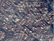
Mapping Application
![]()
Mapping has a special status because it serves as a reference for almost all other applications. These include:
- environment: the design and production of risk prevention plans, impact studies, natural resource management, urban nuisance control (air pollution, noise, etc.),
- town planning and development: urban development monitoring, communal property management, land use management, communal maps, urban equipment management),
- network management (water, sanitation, telephone, electricity, etc.),
- public works and rural development: signposting and road management, impact studies and development plans,
- transport and municipal police: urban displacement plans and public transport management,
- economic and social development: management of city policies and areas of activity,
- protection of heritage and tourism: landscape protection, management of cultural, historical and leisure facilities.
The following mapping information is supplied:
- des photographs,
- des maps (tourist maps, road maps, hiking maps, etc),
- mapping databases (topographic databases and altimetric databases: Digital Terrain Models (DTM), Digital Height Models (DHM), Road Databases...).
The following four types of users are concerned by these databases and geographical information:
- users from the public sector such as administrative services, etc.
- Defense,
- private and consulting companies,
- the general public.
Published in: