September 19, 2014
Products
| Level | Radiometry | Geometry | User(s) |
|---|---|---|---|
| 0 | Raw | Raw | System |
| 1 | Radiometric corrections and PA restauration | Raw | System/Defense |
| Perfect Sensor | Idem 1 + PA/XS fusion | Raw perfect sensor | Added Value Compagnies ??? |
| Orthoimages | Idem 1 + PA/XS fusion | Cartographic projection | GIS |
| Orthomosaic | Idem 1 + PA/XS fusion | Cartographic projection | GIS |
| Sensor Geometry | Land Geometry |
Level 0
- Raw image given by the system:
- Used for calibration and the measure of the performances
- 5 adjacent bands not superimposed to build the whole field
- Volume for one scene:
- PA: 1.8 Gb
- XS: 450 Mb
Level 1
- Image with the same geometry than the Level 0
- Radiometrically corrected:
- aberrant detectors
- ZIB reconstruction
- ghost images XS AC
- PA restauration
- 5 adjacent bands not superimposed to build the whole field
- Volume for one scene: idem level 0
- PA: 1.8 Gb
- XS: 450 Mb
Level Perfect Sensor
- Radiometry:
- idem level 1
- PA + XS fusion
- Geometry:
- PA + XS detectors rectilinear
- attitude smoothed
- perfect dating / orbito
- Product preprocessed (the preprocessings consist in the elimination of all the effects due to Pleiades instrument and the restitution in a perfect sensor geometry) before projection on the ground:
- users interfaces simplified
- localisation accuracy preserved
- Volume for one scene:
- PA alone: 3.6 Gb
- XS alone: 900 Mb
- PA + XS: 18 Gb
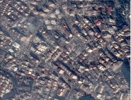
Level Orthoimages / Orthoimages Mosaic
- Projection on the ground:
- corrected of relief effets but not of the superstructures
- Coordinates system geographic or cartographic
- Final product dedicated to GIS
- Volume for one scene: idem PS
- PA alone: 3.6 Gb (nadir 50 cm)
- XS alone: 900 Mb (nadir 2 m)
- PA + XS: 18 Gb (nadir 50 cm)
Published in: