ALOS
ALOS satellite - the ALOS European node
ALOS: an ambitious program
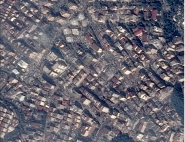
| The Japanese high-resolution Earth observation satellite ALOS (Advanced Land Observation Satellite) is currently the spearhead of the Japanese application program in terms of Earth observation. It will be placed in orbit by the H-IIa launcher towards mid 2004. With a weight of about 3900 kg and an onboard power of approximately 7 kW, it will be placed on a sun-synchronous orbit at an altitude of 691 km, with a revisit interval of 46 days. |
The ALOS mission was developed from the ADEOS and J-ERS experiences, and is based on an advanced spacecraft design aimed at meeting stringent requirements with respect to the accurate mapping of terrestrial surfaces.
ALOS will have three main instruments:
- PRISM: high resolution optical instrument operating in panchromatic mode and used to acquire images from three viewing angles, forward, backward and nadir (tri-stereoscopic instrument),
- AVNIR2: very high resolution multi-spectral instrument, and,
- PALSAR: L-band synthetic aperture radar, high resolution imaging system.
Despite its relationship to the ADEOS-1 and J-ERS satellites, ALOS is very different to its predecessors, with a major technological leap in terms of sensor performance and the ambitious technological choices aimed for, particularly as regards platform attitude control.
PRISM instrument
|
The PRISM instrument offers a ground resolution of 2.5 m. The CCD linear array used has 5000 sensors and requires rapid sampling (14 MHz). The PRISM system uses three independent telescopes to supply stereoscopic images along the track. The telescopes, directed towards the front and rear respectively, are inclined by ± 24° with respect to the vertical. This configuration provides a stereoscopic view characterized by a base/height ratio (B/H) of approximately 1, giving an altimetric resolution of about 3 metres for a ground track of 35 km. In many respects, the PRISM instrument is highly comparable to the HRS instrument of SPOT-5. |
AVNIR-2 instrument
|
AVNIR-2 is a technology radiometer derived from the ADEOS AVNIR-1 model, with a spatial resolution of 10 m for an image width of 70 km. It performs acquisition in four spectral bands covering the visible and near infra-red, and centred on the following wavelengths: Band 1: 0.42 to 0.50 µm, Band 2: 0.52 to 0.60 µm, Band 3: 0.61 to 0.69 µm, Band 4: 0.76 to 0.89 µm. |
PALSAR instrument
| The PALSAR instrument is the second synthetic aperture space radar (SAR) developed in Japan. It operates in the L band (1270 MHz) and in polarimetric mode (4 polarizations: HH, VV, HV and VH). It will be able to acquire images at incidences of between 18° and 60°. Depending on the acquisition mode, the ground resolutions will be between 7 m (fine mode) and 100 m (ScanSAR mode) for swaths of 40 to 350 km, respectively. |
ALOS node concept
Within the scope of the ALOS project, NASDA proposed a particularly original ground management concept consisting in subcontracting user request management and processing capacity to 4 Agencies in different parts of the world:
- NOAA (with Alaskan Sar Facilities as partner) for America (North and South),
- CNES with ESA as partner for the Europe/Africa/Middle East zone,
- GA (Geomatic Australia) for Oceania and Australia,
- NASDA (with GISTDA Thailand as partner) for Asia and the Antarctic.
The European node is called ADEN (Alos Data European Node).
The zone belonging to the European data node (also referred to as the ADEN region) covers the entire European and African continents, together with a large part of Greenland. A node is defined by the origin of the users in its zone (and not by the origin of the data). For example, if a European user needs data on South America, he will apply to ADEN. The European node will then send the request to NASDA, which has all the raw data. On the other hand, if data on Europe is to be acquired, the ADEN node, which systematically receives the raw data on its zone, will not in this case have to supply any complementary requests.
The reason for this type of procedure stems from the need to offer users a single entry point, irrespective of the type of request. This process also ensures that there is an autonomous distribution policy from one node to another.
As a data centre, the node receives level 0 data (on cassettes from NASDA or via an X-band station), and processes them. It generates, archives and distributes level 1 data to scientific and commercial users. It also handles the supply of a catalogue of available products.
The node also provides scientific support via the selection of investigators belonging to the ADEN zone, and the supply of level 1 products required for their work. The Node also helps promote the results obtained.
European interests
The functions of the ALOS high-resolution satellite are of obvious interest to the European entities and users concerned by the development of initiatives such as GMES (systematic mapping of land masses) and/or Earth surveillance. The ALOS satellite in fact offers a unique capability for obtaining multi-spectral optical data, SAR and high-resolution stereoscopic optical data for a given region, over the same sequence in time.
This data will also offer complementarity with existing European missions such as SPOT-5 or ENVISAT; it thus provides faster access to the information required for disaster management, pollution management, etc.
Role of CNES
CNES acts as European program manager in collaboration with NASDA and the US (NOAA) and Oceania (Australian Geomatic) Nodes.
ESA assumes responsibility for the technical development of all ADEN elements, and helps set up deferred time processing resources.
The ADEN-OLAP (Off Line Archiving and Processing) elements, together with the ADEN co-ordination centre (MCC), should be set up in Toulouse.
CLS (Collection, Location, Satellites) should thus accommodate the technical resources. SPOT IMAGE should be substantially involved in the commercial distribution structure.
![]()