Maps / Space Maps
[Around Paris: 1:100 000 scale map] | A map is a tool for understanding areas of land. It is both a transcription of the real terrain and the translation of reflection on a territory. It can contain a large amount of information that the cartographer will be able to synthesise using colours, grids, symbols, text entries, etc. |
A map must be clear, concise and intelligible, whether it is a topographic map, roadmap, tourist map or space map.
Space map
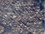
| The Seine estuary - space map with elevation effects SPOT XS images dated 12 March 1997 © CNES 1997 - Distribution SPOT IMAGE ® [Processing: T. Pouchin - Le Havre University] | A space map is a mapping document with a background of image data acquired by Earth observation satellites, possibly combined with additional elements taken, for example, from existing maps, databases or from the interpretation of image data. |
The images making up the background always undergo geocoding processing designed to confer geometric and location properties identical to those of the maps: modelling of the sensor and the image, rectification to correct the effects of relief (we then refer to ortho-images), geometric rectification to comply with a mapping representation system.
The background-image on the space map is the result of extracting a portion of an image or an image assembly (mosaic) according to a basic mapping breakdown (standardisation).
The image data generally undergoes radiometric processing designed to correct certain sensor-associated effects and more generally to improve readability: improved dynamics and local contrast, spectral combination, contour enhancement, etc.
In certain cases, specific processing may be performed to improve the readability of a given theme.
Like any other map, the space map contains certain graphic and text information required for its use.
SPOT satellites are already widely used to generate space maps. Pléiades optical components will heighten this potential.