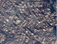
Road Databases
Road databases are dedicated to road applications and geomarketing. The main technical characteristics are as follows:
- a complete description of the road network, both urban and rural, with indications of their characteristics (no entry, direction, etc.),
- high location accuracy both in urban and interurban areas,
- an accurate addressing system, with, for urban areas, street names, building numbers, etc.,
- some detailing: railroads, stations, hydrography, coastline, built-up areas, forests, water surfaces, commune limits, etc.
- etc.
| Road databases may be used as input data to guidance and road network analysis software, i.e. for drawing up road maps. They supply driving instructions indicating itineraries and accessibility, adapt the journey in real time to take closed roads into account, indicate changes in direction, journey time, distance, the cost of the trip and centres of interest along the way, etc. |
Geomarketing
Geomarketing means integrating the spatial reality of economic activities for marketing purposes. This mainly depends on the geographic implantation location. The location of a shop, the geographic prospecting sector of a sales representative, the situation and capillarity of a remote distribution cable network, all these have a major impact on economic activity.
Geomarketing is based mainly on geographic information systems (GIS), used to process databases by connecting information commonly used in marketing - such as the age and gender of individuals, the number of children and type of residence for households, dependent workforce, the sector of activity and turnover of the company market - with information specific to geomarketing: geographic positioning.
Depending on the context and the purpose of the study, geomarketing is concerned with analysing the spatial distribution of information, services or goods consumption and exchange points. Therefore the scope of geomarketing is extensive, from the diversity of sectors of activity which use it to the variety of problems dealt with.
One example is the choice of location for implanting a shop, a shopping centre or a cinema. Geomarketing tools can be used to take extremely varied criteria into account and draw up a synthesis. For example, depending on the information available, it can take into account the number and type of the inhabitants in the area, the fierceness of the competition, the influence of transport facilities, the proximity of roads, stations or any other elements whose absence or presence may affect future activity in the field of distribution studied.
Geomarketing uses the wealth of geographical maps to accurately analyse sales and the distribution network.