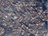
Geophysical risks applications
Although geophysical risks (seisms, volcanic eruptions, landslides,...) belong to "civil security" aspects, scientific knowledge about these phenomena is needed, in order to predict and to quantify their cause and their impact for civil security objectives.
![]()
The images acquired by ORFEO should notably complete the terrain survey which are realized on "sensitive" sites, by extending their spatial representativity. The products derived from the image processing are used to quantify the surface movements before the phenomenon (volcano surface dilatation before eruptions), or by comparison between data before and after the phenomena (cases of seisms or landslides). The use of ORFEO optical or radar images with a high spatial resolution will enable to realize the correlations between images or the interferograms needed for these applications.
![]()
Moreover, as potentially active volcanoes on Earth are known and in limited number (less than a hundred), it is possible to insure their repetitive observation and to measure their eventual dilatation.
For more information: Dynamic geology
![]()
