September 19, 2014
Digital Height Model (DHM)
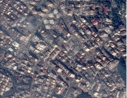
France - Digital Height Model of Paris © IGN | Digital Height Models (DHMs) provide a unique three-dimensional description of our environment. They are altimetry files made up of a regular mesh network of altitudes. DHMs describe the ground profile while integrating what is on the ground surface (buildings, vegetation, etc.). They can be calculated in different ways:
|
DHMs are of great interest for all urban applications, particularly for telecommunications (mobile telephony network coverage).
The very high resolution of the Pleiades-HR component, together with the considerable agility of the satellite, will make it possible to produce DHMs of great altimetric accuracy.
Published in: